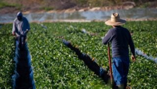
Corteva Agriscience announced today a global agreement with DroneDeploy to use DroneDeploy in its largest ag drone fleet of more than 400 DJI drones across the Company’s global Seed Production and Supply Chain, as well as its Pioneer Strategic Account Management and Agronomy teams in the U.S., Canada, Brazil, and Europe.
Jeremy Groeteke, Corteva Agriscience U.S. Digital Agriculture Lead said, “The field intelligence technology will enable our Pioneer agronomy and strategic account management teams to work with farmers to provide real-time aerial views of their operation.”
The advanced mapping software from DroneDeploy combined with the expertise of Corteva Agriscience field teams offers immediate insights to diagnose and correct agronomic, disease or pest concerns, as well as to optimally place products. UAV operators can survey a 160-acre field in less than 15 minutes, quickly spotting variations in plant and soil health. Every operator will be trained on how best to harness the power of the aerial technology and will be certified according to local aviation regulations.
“We are also deploying the advanced UAV technology in our seed production network,” said Matt Kurtz, Corteva Agriscience Global Seed Technology Lead — Seed Production and Supply Chain. “We are aggressively evaluating and implementing decision agronomy tools like DroneDeploy to enable our agronomists and contract seed growers to make timely decisions impacting seed yields and quality.”
“Based on our market leader position, we are aware that Corteva Agriscience operates the largest agricultural drone fleet in the world,” said Mike Winn, DroneDeploy CEO and co-founder. “Corteva Agriscience is now deploying the most advanced crop scouting technology on drones using DroneDeploy’s Live Map technology to deliver real-time crop insights and enabling immediate actions by their agronomists in the field.”
Here are five ways DroneDeploy is reinventing the way the agriculture industry tends to its crops:
By identifying problems before the spread
Toxic parasites and fungi can destroy a harvest but with DroneDeploy’s advanced imaging technology, field monitors can maintain a constant eye on their crops, identifying problem areas early and preventing spread.
Fields can be monitored in minutes, not hours
Ensuring crop health means knowing everything that is happening in the field. But traveling a 160-acre field can take hours. DroneDeploy’s software can spot variations in plant and soil health on a field that size in 15 minutes.
Better data leads to better planning
With farmers receiving real-time aerial views of the entire operation, they are better equipped to make important planning decisions both during the off-season and during planting, growing, and harvesting seasons.
Assess damage and correct it faster
When weather or other similar damage happens, DroneDeploy’s leading technology allows for fast, accurate, assessment of the damage and provides farmers with the data they need to get it fixed faster.
Taking agriculture practices to a higher level
Drones are great for instant decision-making, but tools like side-by-side maps and the ability to generate variable rate prescriptions for pesticides help with advanced crop management.